Survey on St. Lawrence water level impacts
Do water levels in the St. Lawrence River affect you? Let us know! Whether you're a shoreline property owner or a stakeholder, we're asking for your responses to a survey on the impact of water levels.
Context
In order to update the St. Lawrence water level regulation plan established in the 1950s, the International Joint Commission (IJC) approved a new one: Plan 2014.
This plan helps in determining the water flow through the Moses-Saunders Dam located on the St. Lawrence River between Cornwall, Ontario and Massena, New York and has 3 goals:
- Health and diversity of coastal wetlands
- Perform better under changing climate conditions
- Continue to protect against extreme high and low water levels
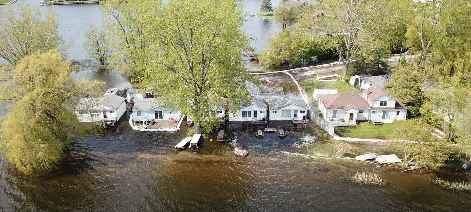
However, the years after launching Plan 2014 were hit with record high water levels in 2017 and 2019, causing floods and losses for riverside property owners and stakeholders, as well as bringing on a review of decisions taken by the IJC in the context of Plan 2014.
In order to better answer riverside property owners and stakeholders’ concerns and ensure that all indicators are taken into account in decision-making regarding water flow management, the IJC mandated the Great Lakes-St. Lawrence River Adaptive Management Committee (GLAM) to undertake an expedited review of Plan 2014.
That’s why commentaries by riverside property owners and stakeholders are so important for Plan 2014’s expedited review. They provide an overview of water level impacts and allow IJC members to make well-informed decisions. To let us know your thoughts, please fill in the GLAM’S survey below:
2022 Water Level Impacts Questionnaire
2023 Water Level Impacts Questionnaire
Feel free to forward this survey to anyone concerned by the St. Lawrence River’s water levels.
Thank you for your cooperation.